Easy
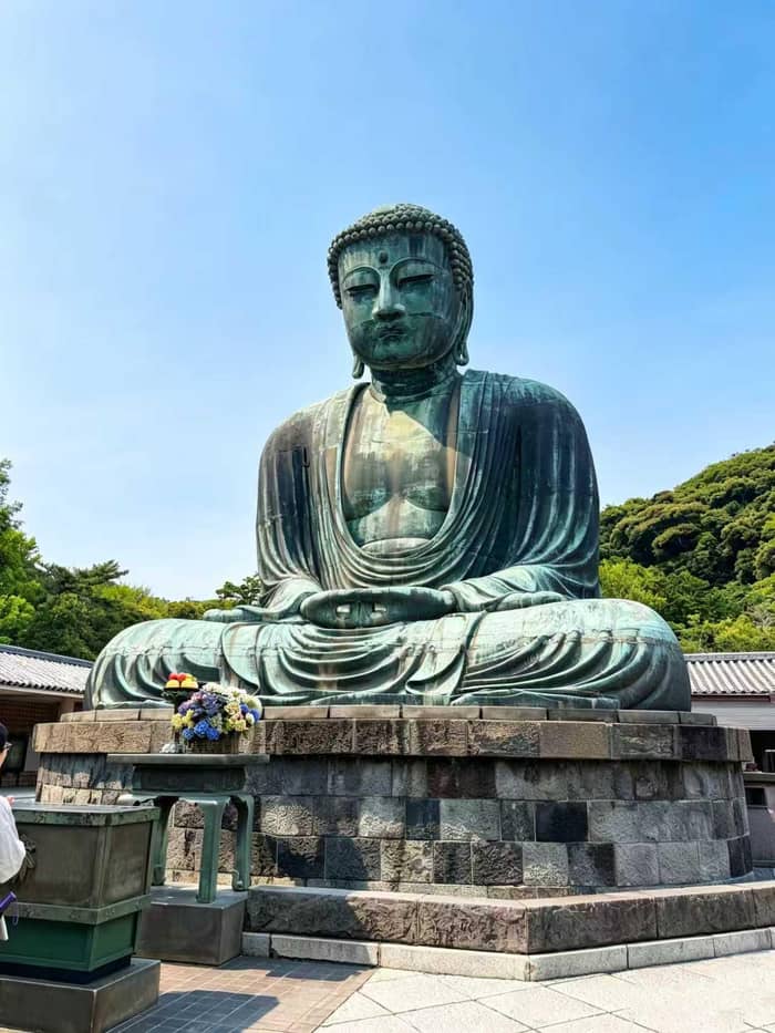
Daibutsu course
Kita-Kamakura to Hase
- LengthAbout 3 km
- Time2.5 to 3 hours
- EndsGreat Buddha
Guides
Language
Currency
Check open daysstarting at $51 · plans can change freeWhere things are
44 places to see
Choose an area, then touch a pin or a name for a short note and directions.
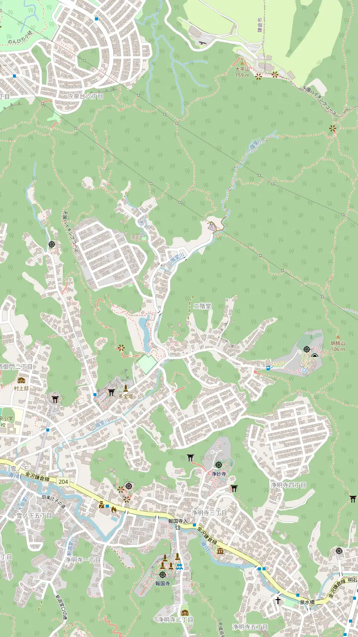
Bamboo garden open 9:00 to 16:00; admission 400 yen, matcha 600 yen.
Rock garden and matcha; open 9:00 to 16:30, adults 100 yen.
A shortcut entrance that climbs about 20 minutes to the Imaizumidai junction.
The highest point of the course at 159.2 m; its one toilet is about five minutes below.
The Tenen course ends at its gate; the stone garden is a Place of Scenic Beauty.
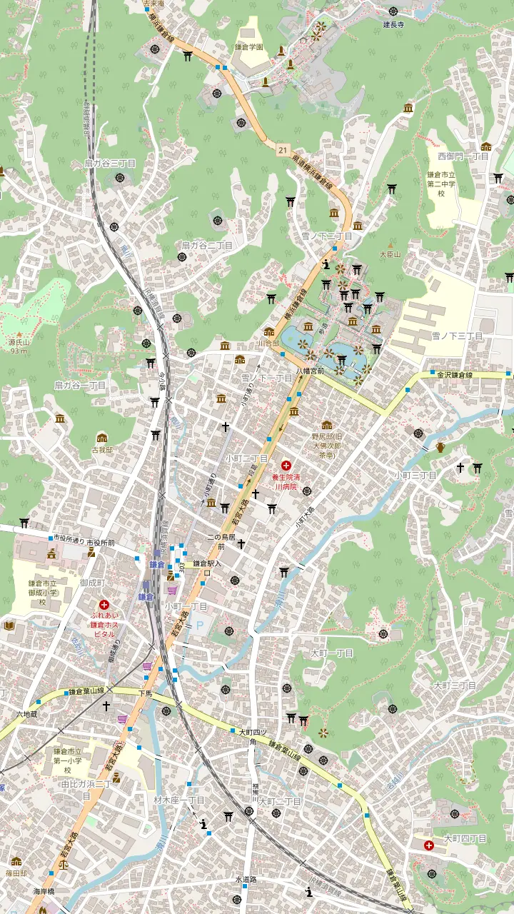
JR Kamakura Station: the shrine is a 10-minute walk from its east exit.
Starts 2 minutes on foot from the east exit and runs to the shrine, with about 250 shops.
Google MapsA straight 2 km pathway from Yuigahama Beach to the shrine, modeled on Suzaku Oji in Kyoto.
The Genji Pond has three islands and the Heike Pond four; lotus blooms here in summer.
Shrine moved here by Yoritomo in 1180; the gate is open 6:00 to 20:00 all year.
Google MapsMuseum opened in 2019; open 10:00 to 16:30 and closed on Mondays.
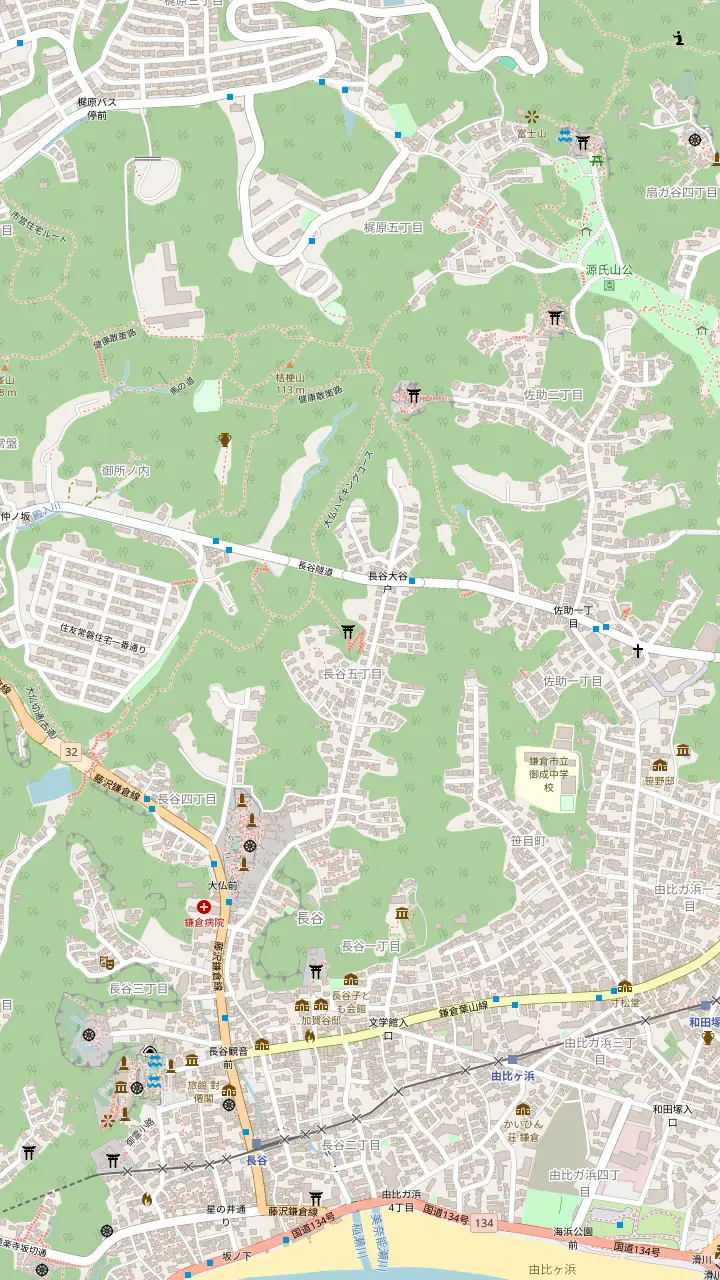
Enoden stop; the Great Buddha is a 7-minute walk and Hasedera Temple a 5-minute walk.
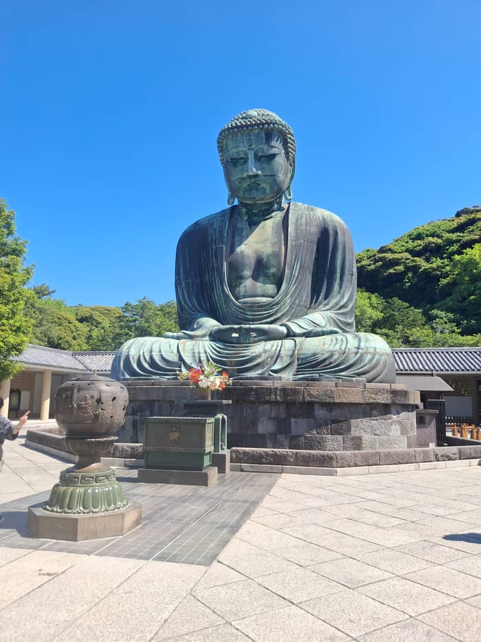
The Great Buddha sits in the open air, a National Treasure about 11.3 meters tall.
Google MapsEleven-headed Kannon, 9.18 meters tall, with a sea-view platform on the upper ground.
Google MapsA spring where crowds wash money; a 20-minute walk from Kamakura Station.
Reached through dozens of red-bannered torii gates and a flight of stairs.
Enshrines the court noble Hino Toshimoto, who died in 1332; 25 minutes on foot from Jochiji.
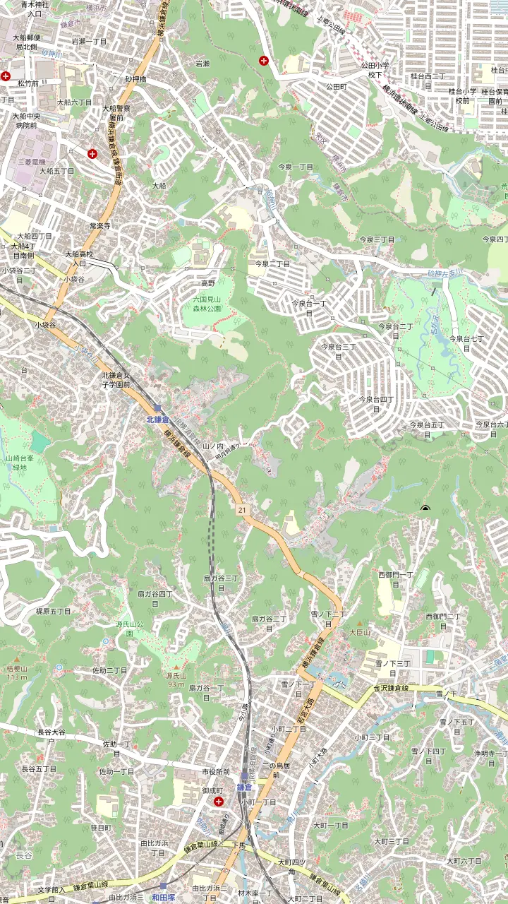
Station for Engakuji, a 1-minute walk away, and for Jochiji.
Founded in 1282; open 8:30 to 16:30 from March to November, admission 500 yen for adults.
Built in 1281; open 9:00 to 16:30, admission 200 yen for adults.
About 2,500 hydrangeas draw visitors to the Kita-Kamakura temples in June.
Ranked first among the Kamakura Gozan; open 8:30 to 16:30, adults 500 yen, cash only.
About 240 steps up from the temple grounds, lined with tengu statues.
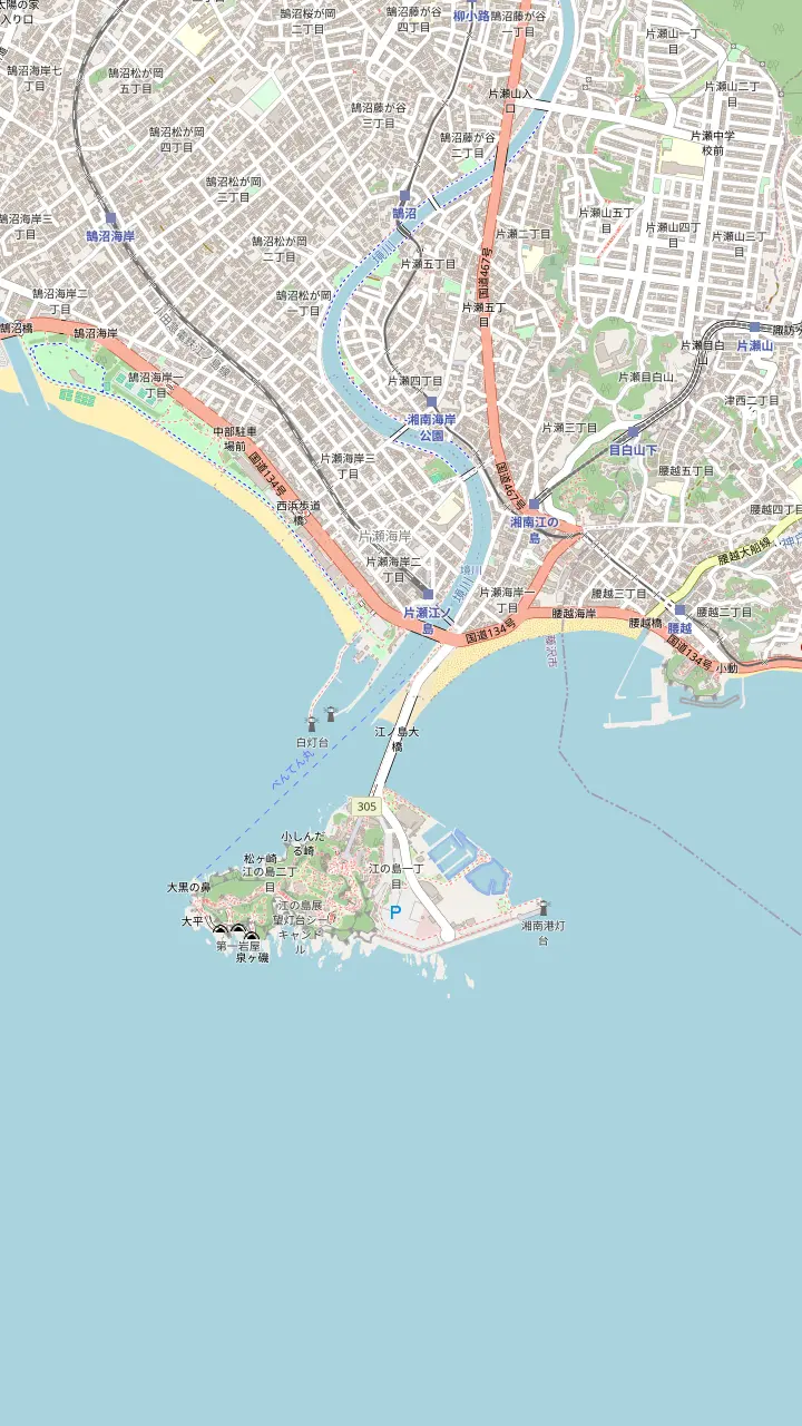
The Odakyu station; the garden is about 20 minutes on foot from here.
Google MapsThe Sea Candle site gives about 25 minutes on foot from here.
Google MapsThe bronze torii stands just past the bridge, and the Benten-maru boat leaves from its foot.
Three shrines make up Enoshima Shrine, first built in 552; the Hoanden hall costs 200 yen for adults.
Google MapsJapan's first outdoor escalator, opened in 1959; a ticket for all sections costs 500 yen for adults.
Google MapsThe tower is 59.8 meters tall and costs 800 yen for adults; the Samuel Cocking Garden around it is free until 17:00.
The third of the three shrines that together form Enoshima Shrine.
Two caves, 152 meters and 56 meters deep, open 9:00 to 17:00 and 500 yen for adults.
A bright light over Enoshima is said to have saved the monk Nichiren here in 1271.
Built as the sailing venue for the 1964 Tokyo Olympics, with around 1000 yachts moored.
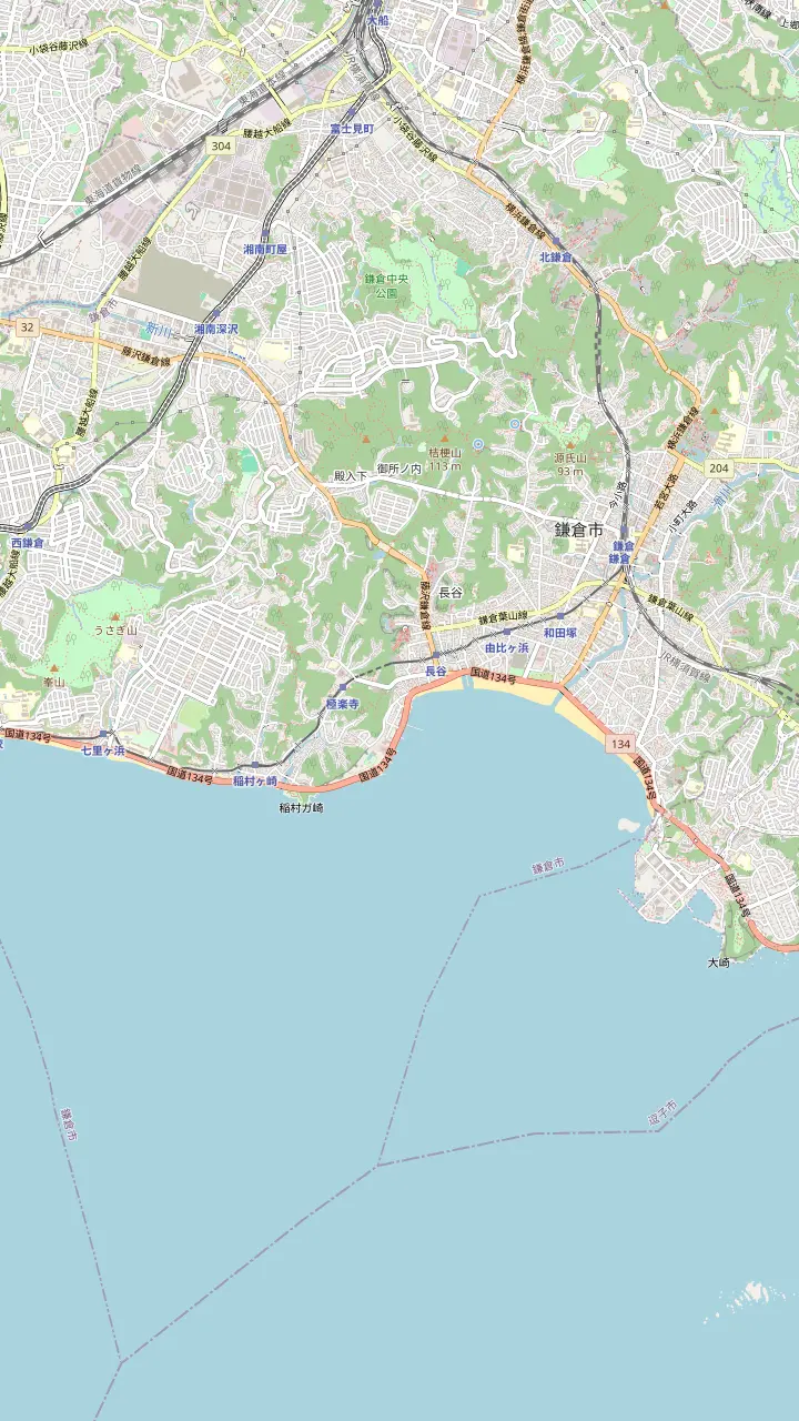
Slightly less crowded than Yuigahama, with a two-minute walk from the Zaimokuza bus stop.
A 15-minute walk from Kamakura Station and 5 minutes from Hase Station.
An Enoden station within 5 minutes on foot of Yuigahama, like Yuigahama and Hase stations.
A cape between Yuigahama and Shichirigahama, free to visit; about 30 minutes is enough.
Popular with surfers throughout the year and known for Mount Fuji views at sunset.
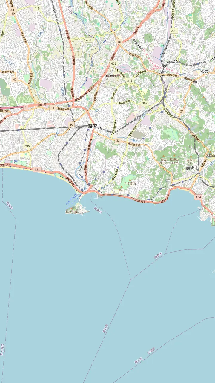
A coastal area that, like Yuigahama and Shichirigahama, draws large numbers of tourists.
Next station along; staff are on hand only from 9:00 to 18:00.
Unmanned station EN08 beside the railway crossing; no restrooms.
A three-minute walk from Koshigoe Station; the harbor shop sells fresh fish.
In 2026 open for swimming from July 1 to September 6; the Tenno-sai sea procession began here at 11:00.
In 2026 open from July 1 to September 13; the Enoshima fireworks were launched from here at 19:40.
Base map: © OpenStreetMap contributors (ODbL)
Kamakura sits in a bowl of wooded hills, and two named paths cross them: a short walk from Kita-Kamakura to the Great Buddha and a longer ridge walk above the temples. Here is how each one runs and what to watch for.
Editorial team, kamakuradaytrip.quest · Updated November 1, 2026 · A 7-minute read
Facts first
Most people picture Kamakura as temples and a beach, yet the town is ringed by hills, and a few well-marked paths run over them. A couple of them are worth knowing by name. The Daibutsu course links Kita-Kamakura to the Great Buddha at Hase, while the Tenen course follows the ridge above the Zen temples and finishes near Zuisenji. Both are short enough for a half day, and both start close to a railway station.
The Kamakura City Tourist Association calls the Daibutsu hiking trail beginner-friendly: about 3 km long, with an estimated walking time of 2.5 to 3 hours.1 The Tenen course is longer, at about 5 km and 2.5 hours according to the same association.2 It offers views of Mt. Fuji and Sagami Bay along the way. Other guides print different distances, so treat any single figure as a planning number rather than a promise.
If you only have time for one, pick by what you want at the end. The Daibutsu route finishes at a National Treasure and a short walk from the Enoden railway, which makes the way home easy.6 The Tenen route finishes in a quiet valley with a garden, which suits a slower day and a picnic. Neither needs special gear beyond good shoes, but both are real mountain paths, not park walkways.
Courses side by side
| Point | Daibutsu course | Tenen course |
|---|---|---|
| Length | About 3 km | About 5 km |
| Time | 2.5 to 3 hours | About 2.5 hours |
| Ends at | Great Buddha, Hase | Zuisenji gate |
| Toilet | Not listed | One, near Ohira |
| Highest point | Not listed | 159.2 m |
| Temple fee on the way | Not listed | Kenchoji 500 yen |
Figures from the Kamakura City Tourist Association's pages for each course.1,2,17,3,18
The trail stretches from Kita-Kamakura to Hase without passing through downtown Kamakura.12 The association lists five places on it, namely Jochiji Temple, Kuzuharaoka Shrine, the money-washing shrine of Zeniarai Benzaiten, Sasuke Inari Shrine and the Great Buddha.13 Walking times between the stops are 25 minutes from Jochiji to Kuzuharaoka Shrine, 15 minutes on to Zeniarai, 15 more to Sasuke Inari and 30 from there to the Buddha.8
Jochiji is the natural starting point, and it deserves a few minutes. It is ranked fourth among Kamakura's Five Great Rinzai Temples, and Kamakura's tallest Japanese umbrella-pine tree stands in its precinct.7,14 Kuzuharaoka Shrine enshrines the court noble Hino Toshimoto, who died in 1332, and the path then drops toward the shrine where a spring draws crowds of people washing money.9,10
Sasuke Inari comes next, reached through dozens of torii gates with red banners and a flight of stairs.11 From there the trail heads down toward Hase and the Great Buddha, whose casting began around 1252.6 The association describes the path as having hardly any challenging sections beyond the gentle stairs near Jochiji, with few exposed roots or rocky areas.15 Much of it winds through thickets, with a few spots that open onto views of the sea and the ridgelines.16
Time on foot
Leg times as the Kamakura City Tourist Association lists them for the trail; stops and photos are extra.8
The Tenen hiking trail is the longer, quieter walk, and it is the one to choose if the Daibutsu trail sounds too short. It begins at Kenchoji, founded in 1253, where temple admission is 500 yen.20,18 A flight of about 240 steps leads up to the Hansobo shrine, and the association adds that the stretch is lined with tengu statues.21 Allow time here: this early section is the steepest part of the day.
Above Hansobo, the Shojoken viewpoint lies about 150 steps higher.22 On clear days it shows Mt. Fuji and Sagami Bay, and from there the path turns into an unpaved hiking trail with exposed tree roots and large rocks. Farther along, the Wameki Juo rock has been selected as one of Kanagawa's 50 most scenic spots.23 The highest point of the course is 159.2 m above sea level, which the association names as the highest peak in Kamakura city.3
Plan your stops before you start, because there is one toilet on the course, beside Kamakura Country Club about five minutes below the Ohira summit.17 The finish is the gate of Zuisenji, whose stone garden is a national Place of Scenic Beauty, and most junctions carry signposts.24 If you are short of time, a shortcut entrance south of Kakuonji climbs about 20 minutes to the Imaizumidai junction on the main course.25
Decision helper
Match the walk to the time and energy you have
If I want one easy half day
Daibutsu course
About 3 km and 2.5 to 3 hours, beginner-friendly.1
If I want views and a ridge
Tenen course
About 5 km, views of Mt. Fuji and Sagami Bay.2
If Crowds put me off
Genjiyama loop
The association's own route avoiding the crowds.19
If I would rather not map-read
A guided hike
A private six-hour hike with a licensed guide.
If I only want sights, no climbing
The day trip on this site
Its stops are shrines, temples, a Buddha and an island.
Pick a walk
Easy
Kita-Kamakura to Hase
Longer
Kenchoji to Zuisenji
Quiet
From Kamakura Station
Both courses are natural mountain paths, and the association says so plainly: some areas are slippery or steep, and the ground turns muddy and especially slippery after rain.4 Wear shoes with grip, not canvas sneakers. Kamakura is also surrounded by mountains on three sides, and heavy rain can trigger landslides and cliff slides, so stay off the hills during and just after a downpour.83
From summer through fall, hornets are active on the trail, and hikers are asked not to provoke them.5 Hawks are another hazard on the way down: the association warns that they aim at food eaten outdoors, so keep your snack covered.84 Bicycles and motorcycles are not allowed on the Daibutsu trail, and open flames are not permitted.85 You use the trail at your own risk.86
Closures happen. A section of the Tenen trail between the Kakuonji Temple entrance and the Ryokuendai entrance was shut on March 4, 2026 after a tree fell, and it reopened at 4:00 p.m. on March 10.87 After a typhoon or a windy week, check the tourist association's news page before you go. Heat is the other risk: Kamakura has few facilities or places that block sunlight, so carry water and a hat in summer.88
Cost calculator
Enter your group size to compare guided options.
Weigh up 3 choices
Enter your group size to compare guided options.
≈
View≈
View≈
ViewStarting prices from GetYourGuide, converted at the ECB reference rate; the booking page shows the exact sum.
Walking order
The Daibutsu course starts at Jochiji, a short walk from Kita-Kamakura Station on the JR line, and ends at Hase on the Enoden. From Hase Station it is a 7-minute walk to the Great Buddha and a 5-minute walk to Hasedera Temple.35 That makes the Hase end a convenient place to finish, because the Enoden runs back toward Kamakura Station.
If you prefer to start from the town, Zeniarai Benzaiten is a 20-minute walk from Kamakura Station, and Tsurugaoka Hachimangu is a 10-minute walk from the same station.39 Joining the trail from that side shortens the day. Walk up through the shrine's neighborhood, then follow the signs for the money-washing shrine and carry on toward Sasuke Inari and Hase.
For the Tenen course, the association's route begins at Kenchoji and ends at Zuisenji. To get back, it suggests walking to the Kamakura-gu shrine and taking a bus from the Daitonomiya stop to Kamakura Station.89 Bus times change, so check the stop's timetable on the day. Enoden day passes can help on the Hase side: the Noriorikun costs 800 yen for an adult and covers the whole line for the day.90,91
Video
Dreams Not Things on YouTube · YouTube stays silent until you press play.
It is a beginner-friendly trail, approximately 3 kilometers long with an estimated walking time of 2.5 to 3 hours.
Checklist
If the main temples feel too busy, the tourist association publishes a route for getting around without the crowds. It links Kamakura Station, Eishoji, Kaizoji, Kewaizaka Pass, the money-washing shrine and Sasuke Inari, then returns to the station.19 It is described as a way to enjoy Kamakura at a leisurely pace, and it uses the hills rather than the main streets.
The leg from Kaizoji to Kewaizaka Pass is 11 minutes, and the walk onward passes through Genjiyama Park.92 This is the same ridge that the Daibutsu trail crosses, so you can join the longer walk at the money-washing shrine if your legs are fresh. If you are tired, you can turn back at the park and take the lower road into town.
The association also runs a live crowd map for Kamakura's sights, where the color of each icon shows the latest congestion.93 Check it before choosing between a busy temple lane and a hill path. City guidance for visitors is to sightsee early in the morning, which also gives you cooler air on the climb.73
FAQ
The association gives about 3 km and an estimated walking time of 2.5 to 3 hours, and calls it beginner-friendly.1
The association page lists about 5 km and 2.5 hours, with views of Mt. Fuji and Sagami Bay.2
It runs from Kita-Kamakura to Hase without passing through downtown Kamakura.12
It stands beside Kamakura Country Club, about five minutes below the summit.17
The association says the path can become muddy and especially slippery after rainfall.4
Hikers are asked not to provoke them.5
Bicycles and motorcycles are not allowed on the Daibutsu trail.85
A section of the Tenen trail closed on March 4, 2026 after a fallen tree and reopened at 4:00 p.m. on March 10.87
Sources
Questions about the Kamakura trip? We reply in minutes.